
Priority Redevelopment Parcels
Scroll down to learn more about the priority redevelopment parcels, including their locations and a brief description of why they rose to the top.
A Draft Market Analysis is ready for review.
To explore all the priority redevelopment parcels, visit this interactive map.
Among other things, priority redevelopment parcels generally . . .
· Do not have active City uses
· Are likely unsuitable for future City uses
· Are located near existing shops, services, community resources, and/or housing
· Are well served by water and sewer utilities
· Are environmentally suitable for redevelopment (no record of contamination, avoid floodplains, wetlands, steep slopes, etc.)
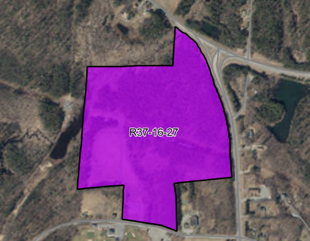
2: Eaton Street and Green Street
• 66 acres (about 16 acres usable for development)
• Close to golf course, community college, and certain businesses
• No DEP record of contamination
• Contains some flood risk areas, wetlands, a river, and a pond
• Limit development to north half of property above the National Grid right of way
• Maintain southern portion as overflow parking for the golf course
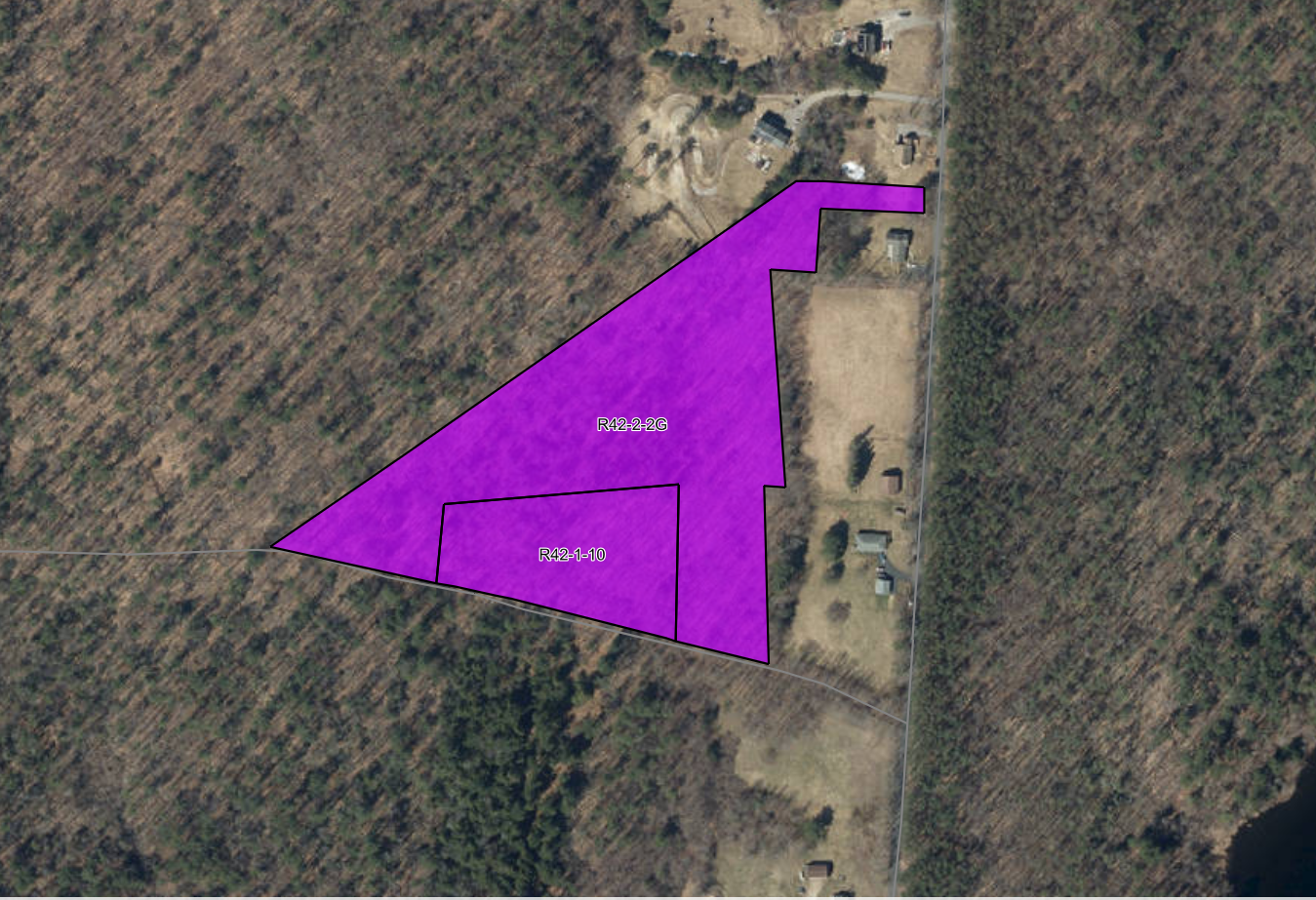
1: John Eaton Road and Stone Street
• 9.83 acres
• Near bike trail
• No record of contamination
• Not in wetlands or flood risk areas
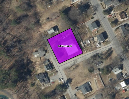
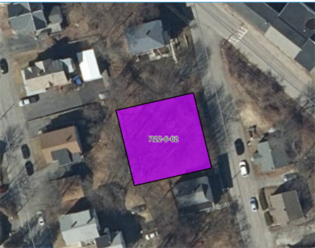
3: Stuart Street
• 0.39 acres
• Near parks, a cemetery, a pool, a playground, and a hiking area
• No DEP record of contamination
• Contains no wetlands or flood risk areas
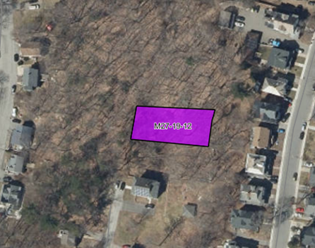
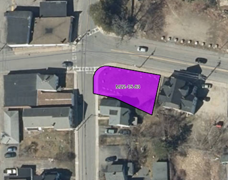
4: Oriole Street
• 0.25 acres
• Near parks, a playground, a library, and many businesses
• No DEP record of contamination
• Contains no flood risk areas or wetlands
5: Grant Street
• 0.16 acres
• It is near an academy, a library, and restaurants and stores
• No DEP record of contamination
• Contains no wetlands or flood risk areas
6: Willow Street and Pleasant Street
• 0.1 acres
• Near a field, a library, a school, a playground and dog park, and various restaurants and stores
• No DEP record of contamination
• Contains no wetlands or flood risk areas